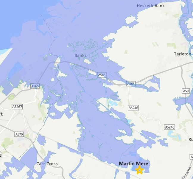
The Crossens catchment is home to dozens of farms on Grade 1 agricultural land which is being utilised for arable crop production, making the region a high priority for England’s food security.
The fertility within the landscape is facilitated by the presence of large areas of peatland soils which are rich in organic matter. Despite its agricultural productivity, much of the land within the area is categorised as Zone 3 for flood risk, which refers to land with the highest possibility of flooding.
At the start of 2024, Mersey Rivers Trust was awarded a grant by the Environment Agency as part of the Lowland Agricultural Peat Water Discovery Pilot (LAPWDP).
This grant funding is being used to develop a solid baseline of the current condition of the peat, as well as looking at groundwater levels, focusing on wetter, less productive areas of the farmland.
As part of this project, Mersey Rivers Trust has been collaborating with local farmers and the Wildfowl and Wetlands Trust at Martin Mere, which is being utilised as a control site to compare its peat condition and groundwater levels with the surrounding farmland.
Ultimately the knowledge gained will provide insight into whether “wetter farming” is a viable option within the catchment. With the data gathered, Mersey Rivers Trust will provide information to local farmers with the aim of improving the overall soil health and water quality locally, whilst lowering the impacts of flood events.
What is Wetter Farming?
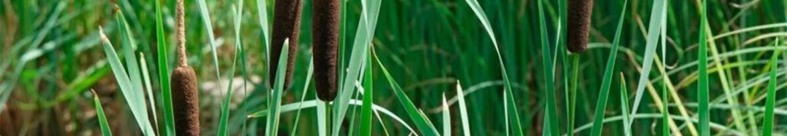
Wetter Farming, also known as Paludiculture, is the practice of growing crops on land that has had its water table permanently raised. Setting land aside for paludiculture to grow crops such as Sphagnum Moss or Typha not only brings environmental benefits, but it can also provide landowners a more economical way of farming areas that are typically less productive.
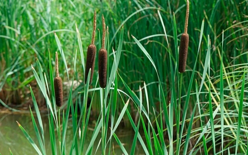
Notably, Typha has been known to bring annual revenues of up to £1.2k/ha. This crop has seen an increase in popularity and viability over the last decade due to its insulative properties and as the clothing industry have looked for ways to meet sustainability goals.
The environmental benefits of wetter farming are extensive. Not only does raising the water table reduce the nutrient run-off and local flood risk, but it can also help with peat regeneration and reduce greenhouse gas emissions. As little as a 10cm raising of the water table permanently can significantly reduce the natural release of methane and carbon dioxide from the soil and therefore the environmental impact of farming.
What we've been up to:
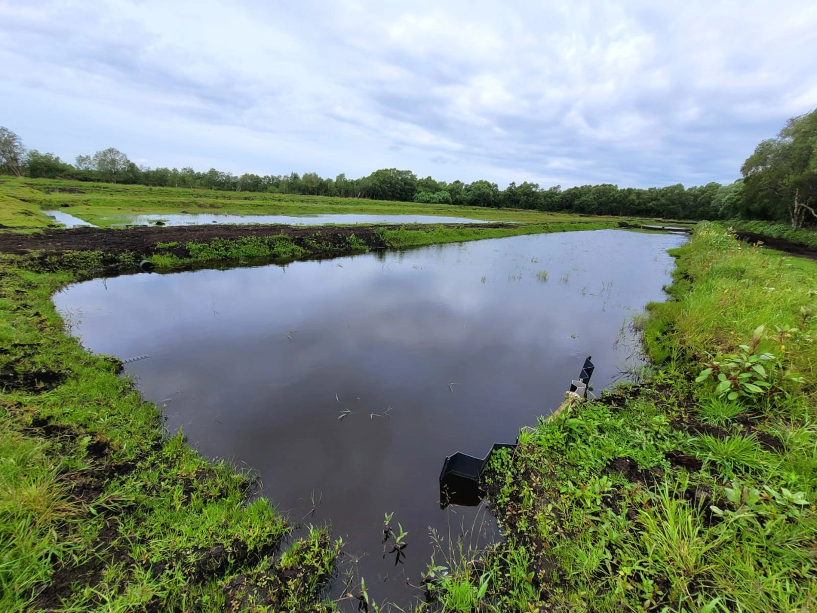
Since August 2024, Mersey Rivers Trust and Wildfowl and Wetlands Trust staff have been collecting groundwater and peat depth measurements at Martin Mere and the surrounding agricultural land.
Groundwater depth has been recorded using a mixture of manual spot measurements and continuous pressure probe measurements. This information is being used to gain insight into how water drains throughout the landscape, particularly following rainfall events.

Peat depth readings have been recorded using a manual peat probe every 10 metres across a transect at each site. This information is allowing us to build a picture of the peat condition in the area. Measurements from Martin Mere have provided a control reference for how peat depths compare on unfarmed land.
This data is being used to generate reports and support future decision making for the landowners.
Share Article