
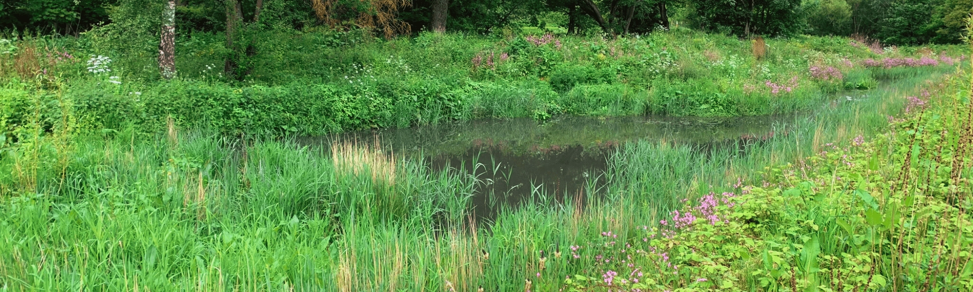
The Alt Catchment NFM Project will implement a variety of NFM measures throughout the whole of the catchment, from leaky dams in Huyton to sand dune management at Hightown. The project, made possible through the Alt Crossens Catchment Partnership, will bring together a wide range of partners including local authorities, NGOs, universities and the local record centre to work together to achieve multiple benefits at a catchment-scale.
Host for the Catchment Partnership Andy Martin shared the news with partners, saying “The successful bid is the result of fantastic collaboration between a range of stakeholder partners from across the Catchment. The multiple NFM projects included in the bid will reduce flood risk, create and improve wildlife habitats, improve water quality, provide valuable learning and promote even closer working between project partners.”
The project will run until 2027, with an initial development phase followed by delivery, subject to business case approval. Find out more about the NFM Programme and the other successful applicants and schemes: 40 projects to benefit from £25 million funding for natural flood management - GOV.UK (www.gov.uk)
The River Alt Natural Flood Management (NFM) Programme is a £2.1m partnership project, led by Mersey Rivers Trust, funded by the Environment Agency. It brings together partners from the Alt Crossens Catchment Partnership to deliver a range of NFM measures throughout the whole of the River Alt catchment, from the source at Huyton to the sea at Hightown.

Phase 1 of the project was delivered in 2024 which involved designing and developing the package of projects across 19 sites. Phase 2 will run from January 2025 to March 2027 and will involve the delivery of the various NFM interventions.
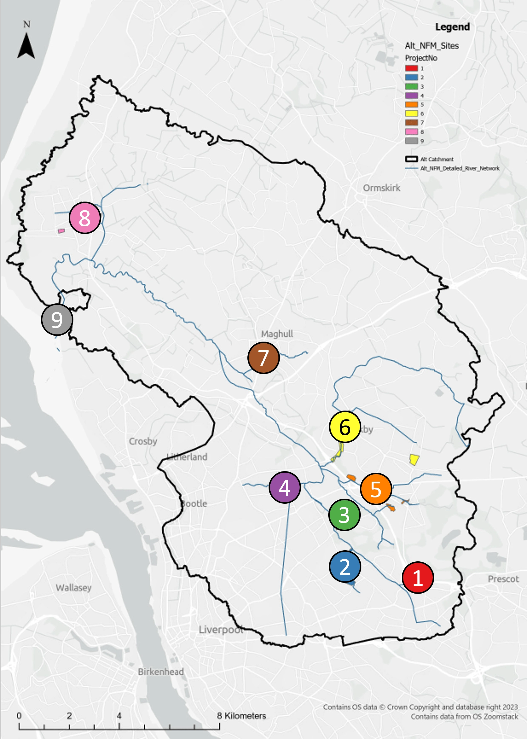
The River Alt NFM Project is split into 9 smaller projects, covering 19 sites. The sites have been packaged together based on the area which will benefit from the flood reduction measures.
- Knowsley/Stockbridge Village
- West Derby
- Croxteth
- Fazakerley
- Knowsley
- Kirkby
- Maghull
- Formby
- Hightown
Project 1 - Knowsley/Stockbridge Village
Oak Plantation
As you make your way along Knowsley Lane, Knowsley, you may notice an unassuming woodland, wedged between you and the M57. This woodland, formally known as Oak Plantation, is, in fact, a historic, mature broadleaf woodland with surrounding meadowland. Oak Plantation was originally part of Lord Derby’s Knowsley Hall estate and now adjoins the Lord Derby memorial playing fields. Comprising 2.78 hectares of lush woodland, grassland, and ponds, it is also home to an often-overlooked watercourse that runs along the western periphery of the site and feeds into the River Alt.

Whilst an idyllic pocket of historic urban green space, much of the site and the adjacent housing is at risk of surface water flooding. Through the NFM programme, interventions such as leaky dam creation (Mersey Rivers Trust) and woodland management (Knowsley Council) have been undertaken. This site is the recent recipient of brand-new footpaths thanks to its landowner, Knowsley Council.
In February 2025, over two volunteer sessions, 8 leaky dams were installed in the watercourse, helping to increase its capacity to hold floodwater. We had the help of several individuals (who luckily didn’t mind getting a bit muddy) from both the local area, the University of Liverpool and United Utilities. These wooden dams were made of three logs all sourced from trees removed as part of Knowsley’s woodland management in an effort to use local, sustainable resources. We were fortunate enough to have witnessed them in action immediately after the building was completed. Make sure to pop down to Oak plantation for a pleasant stroll and see the hard work!


Project 2 - West Derby
Hall Brook
Hall Brook is situated within Croxteth Country Park and flows between a field for livestock grazing and a housing estate. The site is at high risk of both fluvial (river) and surface water flooding. NFM works at this site will include reconnecting the floodplain to increase flood water storage capacity and slow the flow into the River Alt.
An additional offline wetland will be dug in the northeast corner of the field to attenuate overland and groundwater run off. This will provide additional freshwater habitat and storage capacity, and reduce ground water flowing into Hall Brook in events of high rainfall.

Works are due to commence on site in Winter 2026.
West Derby Golf Course
Deysbrook is an EA Main River watercourse and starts approximately 1.2 km upstream of the culvert inlet on Melwood Drive. The watercourse is culverted from Melwood Drive and follows Deysbrook Way and Allerford Road before reverting to an open brook just north of Croxteth Hall Lane. From this point the watercourse name changes to Hall Brook and flows northeast for approximately 350 m before discharging into the River Alt. This network of brooks and rivers collects surface water from upstream and therefore flow levels vary widely and are very responsive to rainfall events.
West Derby Golf Club is partially located within Flood Zones 2 and 3 of Deys Brook. Liverpool City Council are delivering interventions such as wetlands, ponds and river meanders to provide additional water storage, slow the flow of water through Deys Brook, and enhance biodiversity through habitat bunds, aquatic planting and tree planting.
This project is being delivered by Liverpool City Council. Works are due to commence on site in Autumn/Winter 2026.


Consultation event @ West Derby Golf Course Feb 2025
Croxteth Park South
Croxteth Park is a grade 2 listed Country Park, covering over 500 acres of beautiful woodland, pasture, and nature reserve - all of which are open to the public. This project, located to the south of Croxteth Hall Lane, involved the creation of a series of ponds, wetlands, swales and bunds.
The location of attenuation/pond features follows the surface water flood map areas of topographical low points in the land and historic field drains where, during a storm event, surface water already attenuated. The interventions provide localised on-site opportunities for additional water storage (ponds and wetland areas) and biodiversity enhancement (habitat bunds, aquatic planting and tree planting).
This project was delivered by Liverpool City Council in June 2026.

Aerial image showing historical surface water ponding and field drains along boundaries of historically parcelled land.

Project 3 - Croxteth
Dam Wood
Dam Wood is an historic woodland, originally part of the grounds of Croxteth Hall. A series of ditches flow through the site, fed by surface water outfalls from the adjacent housing estates. The ditches flow to the northwest of the site where they join the River Alt. Much of this area is at risk of both fluvial and surface water flooding.
In February 2025, MRT staff were joined by volunteers from the Croxteth Park Volunteer Group (CPVG) to build 11 leaky dams in the main ditch flowing through Dam Wood. The dams will increase attenuation during high flows helping to slow the flow into the River Alt and contribute to a reduction in downstream flooding. They will also help to trap sediment and provide habitat to a variety of birds and insects. The dams were built of brashy material which was sourced on site, providing some additional woodland management benefits.

An additional offline wetland was also created in March 2026 in the northeast corner of the adjacent agricultural field to attenuate overland and groundwater run off. This will provide additional freshwater habitat and storage capacity, and reduce ground water flowing into Hall Brook in events of high rainfall. The wetland was planted with 600 aquatic plants, a wildflower seed mix, and 300 trees which will also provide fantastic habitat for a range of birds, insects and small mammals.

Dam Wood wetland - before (Jun 2025)

Dam Wood wetland - after (May 2026)
Project 4 - Fazakerley
Fazakerley Wastewater Treatment Works
Tue Brook wetlands are situated along the western boundary of the United Utilities (UU) site for wastewater treatment, within the shallow valleys of Fazakerley Brook and the River Alt. The wetlands were created in 1999-2000 as a method of treating highly polluted water from Tue Brook due to industrial estate drainage, urban drainage and combined sewer overflows, before it met Fazakerley Brook. After liaison with UU and a site visit, it is evident the site has not been managed since it was first created over 20 years ago.

Our proposal for this site included full restoration of the wetland, including woodland management, re-digging of the wetlands, sediment buildup removal, channel widening and floodplain restoration. Restoration and increased storage capacity of the wetland would improve attenuation during heavy rainfall and flood events, improve water quality and flow dynamics, and help to reduce local and downstream flooding.
Unfortunately, this project is no longer being delivered as part of this scheme due to some challenges obtaining permissions. However, we hope to deliver the scheme in the near future to help better protect properties in Fazakerley from flooding. Project 10 at Mab Lane has been included in the project as a result.
Project 5 - Knowsley
Willowbed Plantation
Tucked away on the edge of Knowsley, Willowbed Plantation—better known to locals as Bluebell Woods—spans 1.69 hectares of woodland split by the fast‑flowing Knowsley Brook. Sitting just metres from the M57, the site plays an unsung but vital role: acting as a natural buffer that captures motorway runoff. The brook itself cuts a straight, steep‑banked channel through the woodland, sending water surging through at speed.
In March 2025, that dynamic landscape became the focus of a major restoration effort. Staff from across the Mersey Rivers Trust converged on the brook to construct six large woody‑debris dams—an ambitious, physically demanding project made tougher by stubborn bedrock and the sheer size of the timber required to build such substantial structures. Working alongside Knowsley Council’s Woodland Management team, trees growing close to the watercourse were felled and live‑hinged, allowing them to remain connected to their stumps. Trenches were dug along both banks to partially bury the timber, giving it the best possible chance of surviving and continuing to grow.


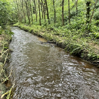


A year on, those efforts are paying off. Inspections show that most of the felled material is still alive, with several dams even sprouting fresh leaves. This will not only provide great habitat, but will also help to keep the dams secure by rooting into the banks.
The impact on the brook has been equally striking. The dams have slowed water flow across roughly 0.2 hectares of the channel on-site, as well as downstream. Their effectiveness was demonstrated during a heavy rainfall event on 22 March 2025, when gauge boards recorded a downstream water level of around 0.5 metres at 19:29, compared with 0.7 metres upstream. The difference revealed exactly what the project set out to achieve: water being held back, stored safely, and released more slowly through the newly dammed system.
Dumbreeze & Clint East Wood
Dumbreeze wood is located in Knowsley and comprises a 0.28 hectare woodland with a watercourse running through the site, part of the Knowsley/Croxteth Brook waterbody. The site is bound by residential housing and roads which are known to flood during high rainfall events. Frequent flooding on Mill Lane, adjacent to Dumbreeze wood, feeds into the channel and contributes to downstream flooding. The watercourse flows from Dumbreeze Wood, under Knowsley Lane and into Clint East Wood, which comprises 1.76 hectares of riparian woodland. The site is bound by an industrial estate to the north, which is at high risk of surface water flooding.
In October 2025, during Flood Action Week, MRT staff, volunteers from the Croxteth Park Volunteer Group (CPVG) and local residents built 9 leaky dams in Dumbreeze (4) and Clint East Wood (5). The construction of the 10th and final leaky dam was delayed due to the presence of a wasps nest! But MRT staff were back at Clint East Wood in December 2025 to finish the job.


The leaky dams were constructed using woody material that had been felled by Knowsley Council through their woodland management project. The dams were raised from the river bed, allowing normal flow and the movement of sediment and fish, but slowing river flow and increasing attenuation within the channel when water levels are higher.
The dams were soon put to work, holding back plenty of flood water. The photo above (bottom left) shows the dam holding back water behind it and a small amount flowing through the gaps and over the top.
BIG thank you to the volunteers who helped us build these dams!
Homer Wood
Homer Wood is located in the ward of Prescot North within Knowsley and comprises a 4.89 ha woodland site with ponds and a watercourse running through the site. The site is located to the south of an industrial estate and to the north of the M57 motorway. The watercourse located within the site is part of a network of tributaries leading to Knowsley brook, via Croxteth Brook. Surface water flood risk is high within the industrial park and downstream housing estate. There are also areas of fluvial flood risk (flood zone 3) alongside Croxteth Brook and, although flood maps show this risk on the opposite side of the brook to the housing, reports from local residents suggest flood water does effect residential properties.
In Spring 2024, Mersey Rivers Trust delivered a project in which a series of leaky dams were created downstream of Homer Wood, within Howard’s Pits. Although this will have helped to reduce flooding, there is still more NFM measures needed.
As part of this project, Knowsley Council undertook woodland management works within Homer Wood. The woodland tree canopy is of one age with an understory dominated by the non-native invasive species rhododendron. This woodland structure meant that the long term functionality of the woodland was compromised. Woodland management included removal of rhododendron and replacement planting of understory species and tree planting to secure the succession of the woodland and enhance the woodland’s function as a flood management system.


Howards Pits leaky dam construction

Project 6 - Kirkby
Millbrook Millennium Green
If you’ve ever passed through Kirkby, Knowsley, you will have noticed an extensive green space running adjacent to Valley Road. Millbrook Millennium Green sits comfortably in the north of this greenbelt and is the largest of the parks managed under Knowsley Council. A Local Wildlife site, running for a cool 0.65km north of Old Hall Lane, the park comprises several habitats, including woodland, grassland, ponds, and a main river (Simonswood Brook) that flows straight through the centre of the site. In the south-east, Millennium Green is home to the historic St Chad's church, a Grade II-listed building that houses a family of Peregrine Falcons in its tower.
Historically, the river was straightened and lined with the same sandstone that was used to build the 19th-century version of the Church (the earliest Christian settlement here dates to the 9th Century AD). This sandstone wall, however, has confined the river to a straight channel that directs water downstream like a funnel during heavy rainfall. As with many tributaries of the main river and the Alt itself, natural meanders have historically been removed, quickening flows and contributing to local flooding.


Much of the site sits within flood zone 3, and many of the adjacent housing estates are at risk of surface water flooding due to outfalls becoming inundated at high river flows. To help slow the flow across this greenbelt and introduce natural dynamics throughout the channel, we opted primarily for in-channel, online restoration. Two-channel widenings were excavated, doubling the width to 5 metres in places. At the largest of the channel widens, an existing dam of willow trees was formalised into an island, encouraging the site to serve as a refuge for birds and passing wildlife. Floodplains adjacent to the river have also been reinstated, adding over 1,300 m3 of capacity to the river channel during high-rainfall events! Offline to the river, we couldn’t forget to capture that pesky surface water runoff, so by St Chad’s we reinstated and expanded a wetland scrape, well positioned to capture water running down through the forest before it reached the river.


To add to the exciting Wildlife of Kirkby, site ecology surveys in early and late summer indicated the presence of a Water Vole population. Confirmed through eDNA testing, we underwent Water Vole mitigation before any excavation, to ensure no Water Vole were harmed in the process. As part of the mitigation, we also ensured that, after the work was completed, the bank was filled with delicious grasses and wildflower meadows to hide under, and steep banks with a 90-degree drop, perfect for their waterside burrows.

Water Vole burrow system at Simonswood Brook

Water Vole. Photo by Jonathan Ridley on Unsplash
Since its completion in April 2026, the site has greened up and already provided capacity by holding water during and after rainfall events!


Valley Park
Downstream of Millbrook Millennium Green, just before Simonswood Brook meets the River Alt, lies Valley Park. Simonswood Brook is notorious for its “flashy” behaviour, with water levels rising rapidly after rainfall. Valley Road, which borders the park, is no stranger to surface‑water flooding either. During heavy downpours, road and surface‑runoff outfalls release large volumes of water into the brook, greatly increasing downstream flow rates.
To tackle these pressures, Valley Park became the focus of a major natural flood‑management project. The plan centred on restoring an ancient paleo‑channel and creating new online wetlands just below the surface‑water outfalls. Work began on Monday, 17 November 2025, led by contractors from Wildbanks Conservation Ltd. Over the course of a week, excavators carved out an impressive 500 cubic metres of extra storage capacity—space that will hold back water during intense rainfall events.
Positioning the interventions directly downstream of the outfalls has already begun to reshape the brook’s behaviour. The newly restored secondary channel acts as a buffer, absorbing the force of fast‑moving water discharged from the outflow. This slows the brook, reduces erosion on the banks, and provides additional protection for properties further downstream that are at risk of flooding. Meanwhile, the emerging wetland habitat is adding ecological value to the site, offering refuge for nesting birds and supporting species such as the protected water vole, which is known to inhabit the wider River Alt catchment.
And the transformation isn’t finished yet. In spring 2026, the site was planted with a rich mix of native, wildlife‑friendly grassland and wetland species. Soon, the site will be a vibrant and diverse wetland habitat.


Acornfield Plantation
Acornfield plantation is a Local Nature Reserve located in Knowsley and comprises mature woodland, ponds, ditches and peatland habitat. To the north of the site is an industrial estate and to the south are residential properties, both of which are at risk of surface water flooding.
The ditch system, fed by rainwater, flows into a culvert before joining Simonswood Brook in a high flood risk area from both fluvial and surface water sources.
In January 2026, Knowsley Council undertook woodland management works at the site to clear large areas of rhododendron, and some small trees and saplings. This has allowed light to the woodland understory to allow smaller shrub and plant species to grow, helping to reduce overland run-off and providing a diverse woodland habitat.
MRT re-used some of the trees and branches, creating brashy bundles which were placed in the ditches - a technique known as ‘gully stuffing’. The woody material helps to slow the flow by increasing channel ‘roughness’, improve ditch geomorphology and create habitat for species.


Project 7 - Maghull
Old Hall Rd Park
An overflow channel from the Leeds and Liverpool canal flows along the northern edge of Old Hall Road Park. The channel flows into Whinny Brook, which feeds into the river Alt. This site is in flood risk zone 3, meaning properties in this area and those downstream in Maghull are at high risk of flooding.
Maghull has experienced severe flooding historically due to development on an area that is, in part, the historic flood plain of the River Alt. Maghull is particularly susceptible to surface water flooding due to the low-lying nature of the district and local surface water systems typically drain by gravity into the River Alt, creating a high flood risk area for hundreds of properties.
Leaky dams in the canal overflow channel will help to increase attenuation of flows upstream within the channel during high rainfall events, slowing the flows that ultimately feed into Whinny Brook, and eventually the River Alt.
Project 8 - Formby
Watchyard Lane Playing Field
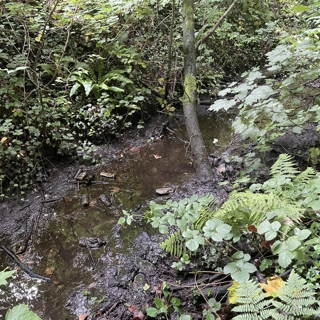
Watchyard Lane Playing Fields is an area of amenity grassland and meadow, with Dobb’s Gutter flowing through the north of the site. The whole of the site is at risk of surface water flooding, as well as many of the surrounding
residential streets. Dobb’s Gutter flows into Downholland Brook, an area of high flood risk from both fluvial and surface water sources.
The main mechanism driving the surface water flooding issues in Watchyard Lane is a combination of Dobb’s Gutter exceeding its banks, surcharged surface water & highway drains, and overland runoff. The low points in this area have been identified as Halsall Lane, Watchyard Lane and Cable Street.


The retrofitting of swales in the greenspace off Watchyard Lane, will help by intercepting a number of surface water flow paths, reducing the volume of surface water entering the surface water drainage network. This will provide betterment for the area generally which could potentially indirectly benefit Halsall Road. Additionally, the retrofitting of a small storage basin next to the watercourse to provide additional storage during extreme events is planned, though this is subject to agreement from the landowner.
This project is being delivered by Sefton Council. Works are due to commence at this site in Autumn/Winter 2026.
Duke Street Park
Duke Street Park is a public open space with several sports pitches surrounded by sparse woodland. Much of the site and surrounding infrastructure is at high risk of surface water flooding. There are various flow paths into Duke Street Park, contributing significant amounts of surface water to the hotspot areas in extreme rainfall events. This project aims to reduce the amount of surface water entering the surface water drainage systems by creating a swale surrounding the sports pitches in Duke Street Park. This will intercept the surface water flow paths and allow it to infiltrate into the ground reducing the pressures on the water sewers in the area. During site visits, there were no obvious constraints in the area and the location of the solution does not impact on the sports pitches currently in-situ. In addition to this it could enhance the area further from an amenity and biodiversity perspective and provide wider environmental net gains.
This project is being delivered by Sefton Council. Works are due to commence at this site in Autumn/Winter 2026.
Project 9 - Hightown
Hightown Beach
In 2011, a scheme was undertaken to formally reconstruct the ad-hoc life expired defences around Blundellsands Sailing Club and to rebuild the dunes to where they were in the 1970s to delay the time needed for further intervention. Since 2011 much of the sand placed to the front of the dunes has been redistributed within the system with significant changes occurring, associated with the series of storms in winter 2013-14. Subsequently there have been signs of more gradual change, though the more recent storms in 2020 appear once more to have impacted on the volume of material on the beach and the dune face. Most recently, Storm Pierrick hit the Sefton Coast on April 9th 2024. The storm happened at the same time as a high tide, which made the effects of the storm even worse, and caused flooding and erosion across the coast.
At Hightown the storm caused a lot of damage to the sand dunes, especially north of the sailing club and on
either side of the United Utilities surface water pipe. The storm washed away a lot of the sand from the dunes. However, that sand then spread out across the beach, slightly raising the level of the beach most noticeably north of the sailing club and at the northern end of the beach.

The area around the sailing club was flooded as waves ran up the revetment.
Where the dune is lowest and there is the greatest flood risk, natural dune roll back is occurring and this will continue to provide protection in the short term. Nevertheless, in the future it is likely that, due to the predicted increase in sea levels and associated increased exposure conditions, this feature will be gradually flattened and there will be insufficient material to maintain the dune ridge. To mitigate against this risk instead of providing material to reinforce the front face, which would be more susceptible to losses from the system, recycled sand would be more appropriately introduced to the rear of the dune crest to provide a wider feature, with the potential for more material to remain in the system as roll back occurs.
The project will use dredged material, that has been infilling the Alt channel adjacent to the site, to recharge the dunes and beach, as described above. Where necessary, marram planting and protective fencing will be used. As the site is designated habitat, a preliminary ecological assessment survey has been completed to inform the necessary approvals, planning, and licences.
A meeting was held with Hightown Parish Council, with several members of the local community present, to discuss the risks at the coast and potential options moving forward. Everyone in the meeting was supportive of works being undertaken to protect the properties and recognised that managing the dunes for coastal defence could provide benefits for habitats and species as well as the coastal protection function.


Project 10 - Mab Lane
Info coming soon...!
Monitoring
Monitoring of Natural Flood Management measures is a key aim of the NFM Programme. Much of the available evidence of the effectiveness of NFM is based on anecdote, rather than data. This lack of evidence has largely been due to the ‘quick-win’ focus of grants, with funds only provided for installation of measures, rather than the thorough feasibility, design and pre/post-monitoring of rivers and interventions.
The EA’s £2.5 million NFM Programme allowed Mersey Rivers Trust, and partners, to collect pre and post project data for the first time, to assess...
Are the interventions working?
Is the chosen site/intervention the most suitable?
Is taxpayers money being used in the most effective way?
As benefits often take several years to appear, long term monitoring is important to fully understand the impacts of NFM measures. Although the EA’s NFM Programme is a step in the right direction, longer term funding is still required.
Monitoring techniques
The following parameters are being measured before, during and after installation of the NFM interventions, and upstream and downstream of the interventions. This will allow us to compare data to evaluate the effectiveness of the NFM techniques used. Evidence that the interventions aren't working is just as important as evidence that they are!
Water level - changes in the height/depth of the water
Flow - how fast the water is moving
Rainfall - DEFRA 15 min rainfall data
River MoRPh - citizen science technique to record river bed and bank natural features and human pressures
Water quality - citizen science-level testing of phosphates, water temp, pH, turbidity, and invertebrate ‘kick’ sampling
Coastal vegetation & zonation surveys - Dynamic Dunescapes citizen science methodology to monitor changes to dune systems and abundance of plant species. You can read our 2025 report here: https://tinyurl.com/bdt3ur2w
With thanks to Professor Neil Macdonald from University of Liverpool for his support with the hydrological monitoring.

Spot flow monitoring

Water quality monitoring

Invertebrate sample full of Freshwater Shrimp
Share Article